










The product's shade and actual color may differ from what is shown in the picture, as the images are for illustrative purposes. The product description is general and may not include all the product's features.
Garmin 010-C0756-00 navigator map Road map
212,60 €
Monthly payment from 6.37 €
947720 010-C0756-00
0753759069360
Shipping 1-2 b.d.
You are interested in this product?
Get a fresh perspective when you take to the water with BlueChart® g2 Vision®. With BlueChart g2 Vision data, you’ll get detailed marine cartography that provides convenient viewing of nautical content and other premium features. BlueChart g2 Vision allows you to see your vessel’s precise, on-chart position in relation to naviads, coastal features, anchorages, obstructions, waterways, restricted areas and more. You will also have access to detailed mapping capabilities that include Safety Shading, Fishing Charts, smooth data transition between zoom levels, harmonious transition across chart borders, and reduction of chart discontinuities. Premium features include 3-D perspective above and below the waterline, Auto Guidance, high-resolution imagery, and “real picture” aerial photos of ports, harbors, marinas, waterways, landmarks and other points of interest. It’s the most realistic mapping display Garmin has ever offered.
Click the Products tab to see if this map is compatible with your Garmin device.
Coverage
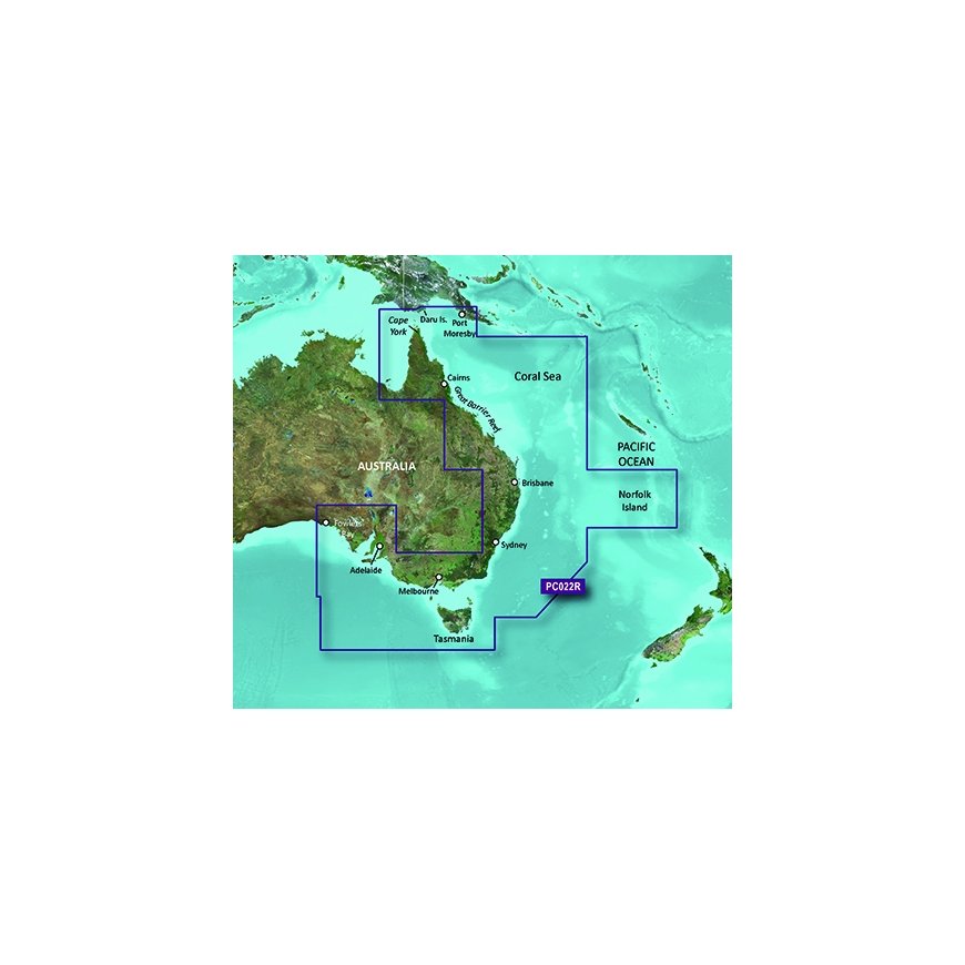
Detailed coverage of the Eastern coast of Australia from Mornington Island to Fowlers Bay. Also includes detailed coverage of Cape York, the Great Barrier Reef, Brisbane, Sydney, Melbourne, Adelaide, Tasmania, and Norfolk Island.
Other features | |
| Geographic coverage | East Coast Australia |